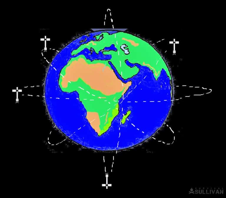
The Global Positioning System is a network of satellites that integrate your position on the earth, your speed, distance, and direction.
The function of a compass, map, odometer, and speedometer are all present in one compact and portable device – commonly known as the GPS device.
It simplifies the math needed to calculate all of the above, making route planning and course maintenance easy and user-friendly.
The modern handheld GPS can do a multitude of tasks, from planning your next hunting or fishing trip to finding and confirming your direction, to helping you find your way when bugging out to the woods.
Now, there are two ways to access the GPS network, either by direct satellite uplink telemetry or via the cellular network system.
The advent of micro-technology has revolutionized GPS hardware systems that were the size of a large military radio with about the same battery life.
The GPS system is a relatively new technological development considering we invented the wheel 6,000 years ago.
The wheel is considered one the most significant inventions of all time and, as with most advanced technology, it has its roots in military applications.
Today we track everything from freight and trucks to aircraft and humans.
Inmates from prison that are on furlong or restricted parole have ankle monitors that track their movements and report automatically if the wearer moves out of a certain neighborhood.
In this article we’ll talk about the main types of GPS systems, and how you can use them to find your way when lost.
Table of Contents
A Short History of the GPS
The GPS system as we know it has beginnings in the marine and aviation industries, and its foundation is set in the 1960s, deployed by the US military.
It was developed by Bradford Parkinson working with the US Airforce; Bradford’s work mapped the framework for the modern GPS as we know it.
In 1973 the US Department of Defense official commissioned the GPS project, the project itself took 20 years to become fully operational with the full complement of 24 satellites coming online and providing the necessary 24/7 coverage to ensure the GPS remained in continuous operation.
In 1974 the US Company NAVSTAR launched the first official tracking satellite with a total of 11 satellites making it into orbit by 1978.
Developments in Silicon Valley aided the exponential growth of the GPS system with advances in data processing and nanotechnology.
Relegated to a footnote is a US company called Etak, headed by Stan Honey the systems engineer, and the man that started Atari (that’s right the first real video gamer) Nolan Bushnell. In 1985 they made the first commercially available guidance system.
The two men conceived of the idea while at sea racing a yacht, using the early doppler satellite system initiated in the 60s.
It was clear that there existed a need for a more accurate satellite system that required less input and mathematical calculations.
The use of dead reckoning and recording of speed was still needed to plot one’s position. In essence, the satellites worked like stars with a regular orbit.
In 1983 the US Government allowed the civilian market access to the GPS system, and in 1985 opened up GPS development to the private sector.
This led to private companies developing portable, mobile devices, with the Nav1000 handheld GPS making its appearance in 1986.
The aviation industry was the major beneficiary, with safety standards and navigation accuracy increasing in leaps and bounds.
The space race took on a new dimension with the advent of satellite guidance, the ability to see every piece of the earth with pinpoint accuracy changed the nature of warfare and the effect it had on the psyche of governments.
An upside to the space race is that it ignited scientific advancements in other countries, denying one country total control of the precision mapping and plotting network.
America was the first to initiate the GPS system in 1978 with the then Soviet Union having an operational system by 1984 called GLONASS, basically Global Positioning System in Russian.
The Chinese got going in 2000 with their BeiDou system which evolved to become fully operational in 2018.
The European Union decided to launch its own independent system in 2002 called Galileo.
It went fully operational in 2016, sporting an integration capability with the US GPS system giving it a high degree of accuracy.
Types of GPS
Handheld GPS Devices
There are varying types of portable GPS handheld devices on the market, varying from the very basic to the highly sophisticated, and a few in-between.
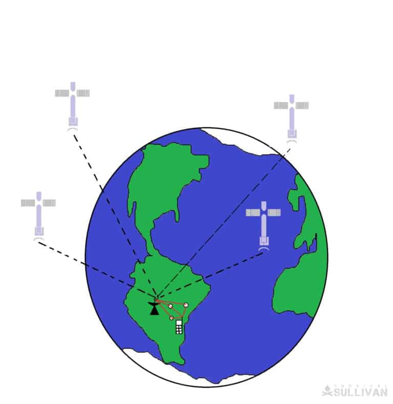
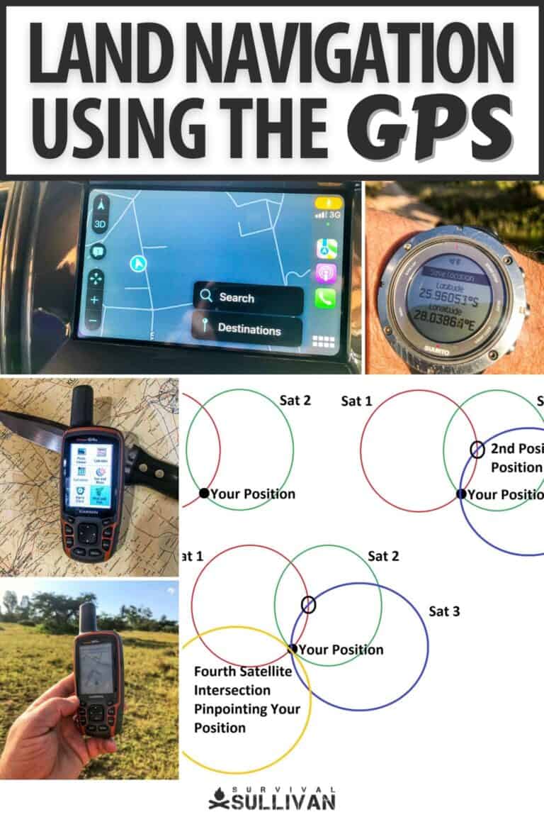
Two satellite positions will give you a position relative to the general area you are within the intersecting circles.
Three satellite positions will place you in an approximate position having two possible locations, your GPS is smart and will pick the one closest to the Earth since satellites operate in a 3-dimensional world.
If your position is at sea level the GPS will be accurate to within meters, if you’re in the high reaches it can be out by hundreds of meres.
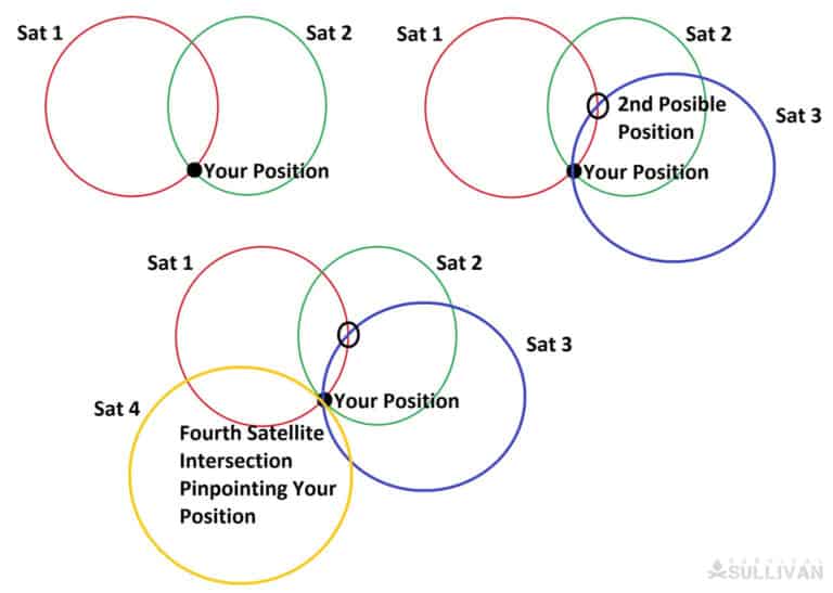
Four satellites will have one point of intersection giving your exact position.
The GPS device is a direct uplink device to the satellite system and will work in areas without cellular reception, are far superior in accuracy and dependability.
The device needs a minimum of 3 satellite links to establish its approximate position; this is called triangulation. Four satellites will give you an exact position.
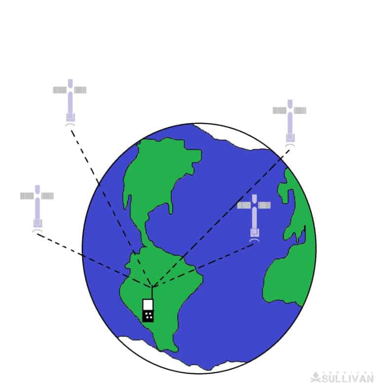
The GPS device receives a data packet directly from the GPS satellite which enables the GPS device to interpret as location, time, and distance information.
Disclosure: This post has links to 3rd party websites, so I may get a commission if you buy through those links. Survival Sullivan is a participant in the Amazon Services LLC Associates Program. As an Amazon Associate, I earn from qualifying purchases. See my full disclosure for more.
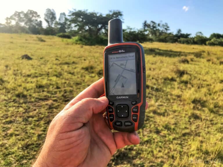
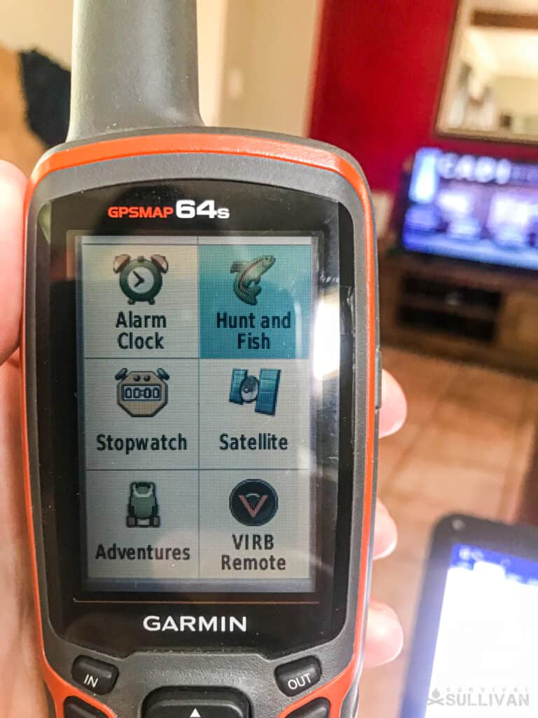
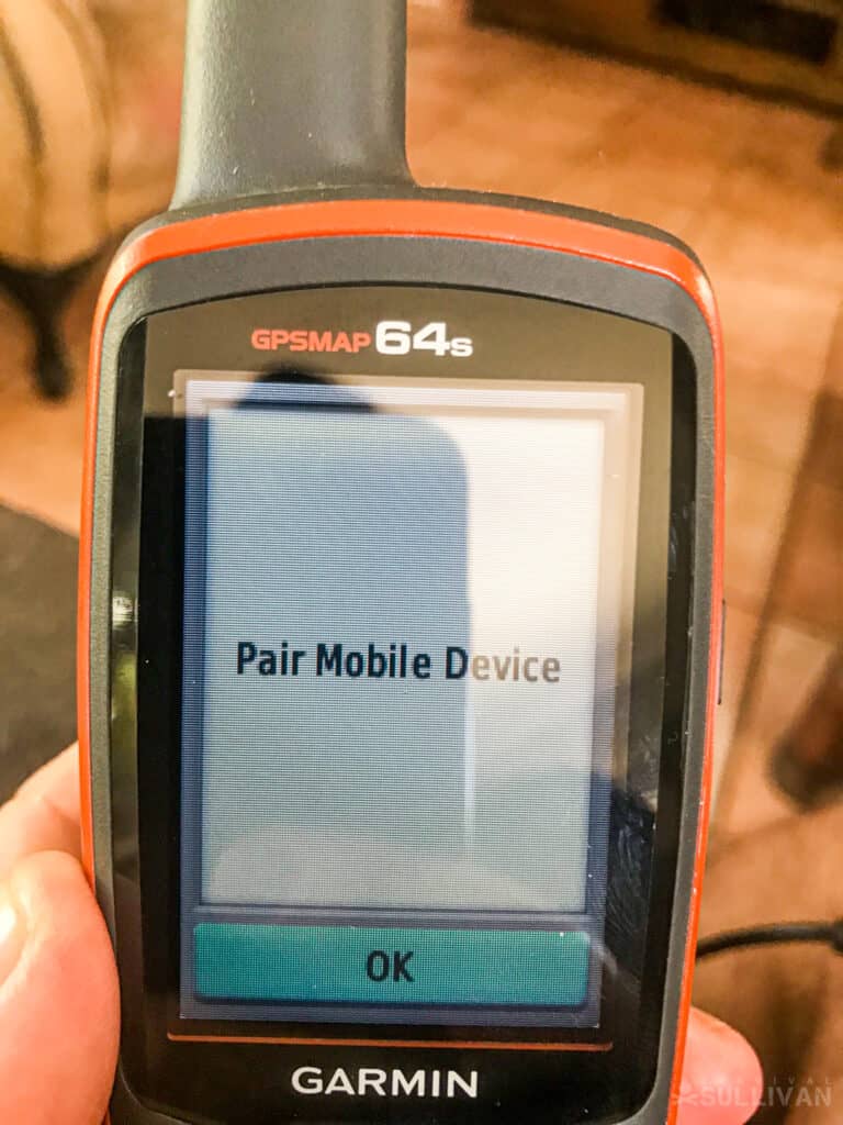
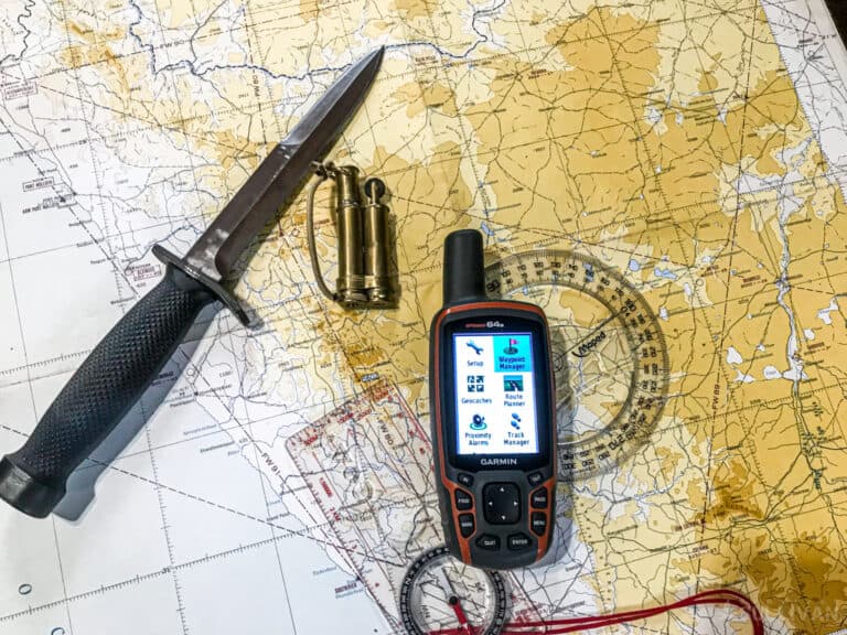
My personal favorite is the Garmin 64s, a really good mid-range device that covers all the bases and then some. It will cover the US-based GPS with the same integration package as GALILEO.
It’s a rugged design and can handle rough handling which is necessary on combat deployments. It is waterproof with a large display screen and lightweight.
The wireless Bluetooth connectivity means I can link it to other devices, such as phones or computers with map integration.
Even the more basic models will give you the important positioning features, location, mapping, and compass capability.
My advice is not to go with a small screen, get a model that shows more than longitude and latitude and has the mapping feature, preferably in color.
Do not buy cheap, you’ll be frustrated and disappointed. More importantly, cheap versions will leave you in the lurch especially when you need them most.
The second most important feature is battery life, remember that high-end features are demanding and drain power, so prepare for that.
Technology is power-hungry, and your preparations should include multiple sources of renewable energy.
Smartphones
Cellular communication revolutionized the telecommunication system, taking us from Alexander Graham Bell’s early invention to phones that are more powerful that the first computer that launched NASA space missions.
Today it is all about the ability to maintain a data uplink to the nearest cell tower which allows us access to the worldwide knowledge base, the internet.
Every phone has the ability to download and store a multitude of applications or Apps, that enable us to manage, plan, and access information on a daily basis.
One feature is navigation, and our phones now have the ability to “find” us pretty much anywhere in the world, provided we have a connection.
With service providers allowing each-other access to their networks, the cell phones have gone international, and we can locate our position in real-time with a huge degree of accuracy – up to 4 meters from your actual position.
Google Maps, Waze, Apple Maps, and a myriad of others are available to download directly to your phone giving you access to maps that cover most of the world, but especially human development.
Whether you are in Houston or Tokyo, your phone will ‘find” you, and give directions to streets, roads, avenues, and places of interest, restaurants, and takeaways.
No more printed street maps or map books; your phone will not only find you, but it can guide you.
All of this thanks to the GPS system and satellite guidance systems in place around the world. As technology has developed so has the smartphones’ capacity to evolve.
There are various apps available now that can access the GPS system’s data packages even if offline. No cell tower uplink is necessary to navigate using the GPS system.
The more accurate ones require a minimal yearly subscription to access the premier features, similar to a GPS, the basic features will still give you access to the GPS system and will help you navigate.
I have three on my phone, following the rule of redundancy, “Two is One, One is None”, namely:
Watches
As an operator in hostile environments timing is an absolute necessity. We use the time for every part of our planning from when we go, to how long to get there, to how long it will take to complete a mission.
Watches using GPS systems are similar to handheld devices. They can directly access the satellite network or can utilize the cellular network to access the various GPS systems, independent or linked to your cellular phone.
Watches are limited in their ability to provide guidance as in tracking and feedback on a map but will be able to give you location and keep track of your routes.
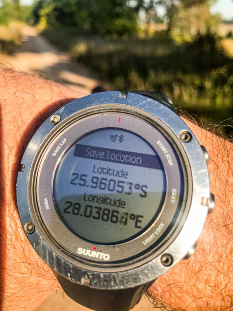
The longitude and latitude coordinates will reference on a map, they can log your track, and save your position.
I have the Suunto app on my phone which will download my track via bluetooth, so no need for a cellular connection, allowing me to find myself on the maps loaded on my phone.
My personal favorite is the Suunto range of timepieces. I started with an X10 back in my early days as a contractor, and now use the Suunto Ambit 3, which is due for an upgrade in the near future.
The Garmin Fenix series is also reliable and durable, which can stand up to heavy wear.
Most products on the market are rechargeable and will give you days to months of reliability depending on the applications you use.
I find that the satellite navigation uplink is the most demanding but will still give three to four days of continued use.
I get a little more by finding my position and then using the compass feature or a compass to navigate e my route, checking from time to time to ensure I have maintained course.
The GPS and Modern Modes of Travel
Modern transportation has shrunk the world we live in, with more cars, trucks, ships, boats and aircraft on the ground, on the water, and in the air.
The GPS systems are in place not just for military use. In general, the civilian world makes far more use of the system to keep the world safe, than any of the world’s military.
Parcel tracking and package delivery are much more reliable now, with less possibility of criminal activity or opportunity.
Vehicles can be tracked if stolen. If you’re in an accident the GPS transponder, if programmed will send an emergency signal to the call center. Your position can be tracked, and assistance rendered.
Motor Vehicles
In an ever-changing technological world, our everyday lives are made more convenient by the upgrades that electronics bring to our lives.
The Ford Model T was the first automobile to be affordably available to the masses. How indispensable to our lives has vehicular transport become!
Staying safe on the roads has become easier with the GPS, getting us to our destinations on time, warning us of impending danger, giving us safe alternatives, and setting a new standard in navigation.
Moving off the beaten track, satellites will keep you company when your cellular network is left far behind. A GPS will give you access to navigation no matter where you are.
I have run operations in Sudan Mali, Mauritania, Somalia, Congo, Angola, the Sahara, and everything in between, and have always managed GPS uplink telemetry.
A tour into Syria (overland from Jordan) would not have been possible without access to the GPS system.
Aircraft
Air travel is by far the safest mode of transport, however when it goes wrong it’s normally tragic with a massive loss of life.
The loss of life heralded the turning point for military exclusivity of the GPS system. The Reagan administration recognized the fact that this could have been avoided if the airline had had access to the GPS, and subsequently made the GPS system available to the general public.
GPS systems have increased navigation reliability with a substantial decrease in error, making the skies that much safer.
Boats and Ships
After land navigation, sea travel was the way nations spread, opening up trade routes, exploration, and discovery.
We have come a long way from the compass and dead reckoning, which are still the basis of all navigation.
The sea, as with the skies, has become well populated and run the real risk of collision and running aground.
The GPS system has derisked these threats to life, cargo, and ecological disaster, keeping the shipping lanes ordered and safe.
Applications
In a survival situation a GPS is first prize, not only will it give you your position relative to the earth’s surface, it will be able to identify the nearest human habitation, rivers and lakes, roads, paths, and land features that you can use to plan your route to safety.
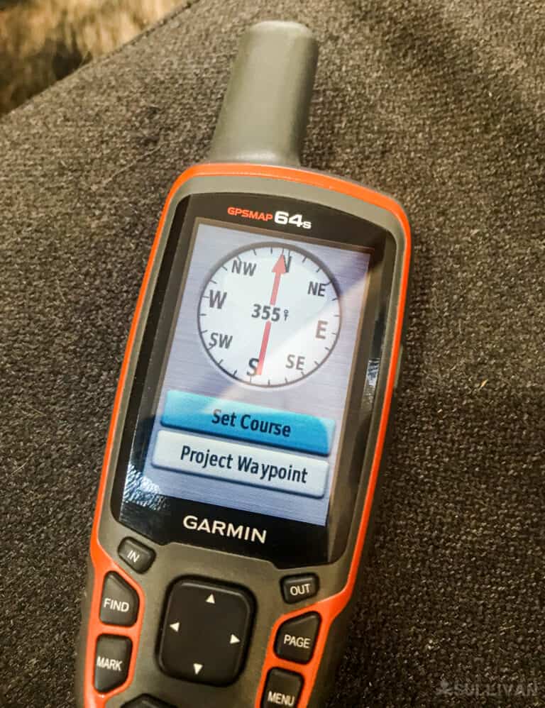
All GPS devices will have a compass that you can use to quickly orientate yourself to your surroundings and guide you to your various catch points.
Advanced features will include barometric pressure to help you plan for bad weather, and ensure you find adequate shelter before you get caught out in the open.
Even your hunting and fishing will get some help from your GPS system, providing you with the best times to fish and hunt.
When out hunting set your return track, you’ll never get lost, you’ll find the quickest and safest route home, conserving valuable energy and feeding your mental wellness. A solid mind in any bug-out situation is the first tool in your survival arsenal.
Your phone will be able to aid you in the same way if you have a cellular connection.
The problem is that the cellular networks rarely extend into the more remote areas, leaving you with no way to load your position without the help of a GPS satellite uplink.
With Bluetooth connectivity you can establish a link between your GPS watch and your GPS device:
The versatility of technology and its ability to interface make cellular phones and GPS devices make the world a smaller place.
This compatibility between devices can be the difference between life and death.
It is vital to familiarize yourself with your equipment and its capabilities. The functionality of the cellular system is enhanced with supporting equipment.
Using Your GPS Device
GPS uses cases range from the easy to fairly complex, that said the functions are normally self-explanatory and with a little practice and with the systems guide for the device you are using you will be able to operate your device with confidence and ease.
Most GPS devices work on a fairly simple basis, with finding your position the most basic, it is a matter of pressing the search key on most devices. The mapping and tracking take a little practice but it’s fairly simple.
The GPS functionality works on the same principles as map and compass work, with the ultimate goal of self-navigation from a starting point to a reference point or desired location.
Your GPS device at the higher end is a combination of map and compass, giving you a visual, accurate representation of the ground in front of you, the same as a map does.
Working as a compass, it will give you exact directional bearings, showing True North without having to allow for magnetic declination:
Even as a GPS device simplifies your navigational functionality, you can’t forget the navigation basics:
Distance
Once you have planned the route you will take it is important to know how far you will travel.
Measuring out your distance will allow you to gauge the terrain, and the time it will take to navigate from one catching feature or waypoint until you have reached your final destination.
Distance = Speed x Time
Duration
The age-old question from the back seat of the family car,” Are we nearly there yet?” Can now be safely answered with the use of GP planning.
If you’re on foot and have an idea of your traveling speed, which you can obtain from your previous expeditions while practicing the use of the GPS, you can plan your timing so as to arrive before sundown for example.
Time = Distance over Speed
Speed = Distance over Time
Some GPS devices allow for the input of information that will help you with the calculation and also continuously update arrival times as your progress is measured by the satellite tracking system.
Direction
Once you have plotted out your course take down the coordinates and direction in which you will travel. Using the compass feature on the GPS you can shoot a bearing to your destination or the first of your catching features or waypoint. You are ready to set off and navigate with confidence.
As with map reading and any off-trail navigation, it is important to hedge your bet when traveling, making sure you get to your way with as much accuracy as possible.
Remember Aiming Off, is a useful tool when hiking to ensure you stay on track. If your first waypoint is a prominent rocky outcrop, at which point you will turn off left to take a curse t your next waypoint.
Shoot a bearing to the right of the rocky outcrop that ensures you will not miss the feature.
Using your GPS Tracking application will keep you on track by plotting your course on the map on the GPS or giving you accurate coordinates, which can be followed on your map and ensure your arrival on point.
Description
The GPS Map can show you what a map can and help you identify ground features that are easily identifiable, such as a rocky outcrop, river, lake, or mountain range, for example, that can be used as catching features and waypoints.
These waypoints can then be used as handrails to guide to the next point.
GPS maps also show programmed waypoints on certain routes, like forester stations, fire lookout towers, hiking overnight stops, and points of interest (POI). You can use these to navigate safely and with confidence.
Destination
The beauty of the GPS is the satellite bird’s-eye View feature which allows to take a look at your waypoints and destination as a real image.
Loading Maps onto your GPS
Most GPS devices are preloaded with maps of the United States, North America and the Caribbean.
These maps may vary in detail and content, it is advisable to ask before purchasing what maps come preloaded and what the upgrades would be needed.
Most GPS manufacturers will allow the purchaser to download maps from the internet.
Other maps may have to be purchased on CD Rom and loaded by you or they could come on a memory card that can be inserted into the GPS device or a computer and downloaded onto the GPS device.
Garmin offers a downloadable version and many independent providers offer this downloadable feature too.
Some will offer free upgrades on your initial purchase, and provide further mapping or topographic versions of the road map versions.
Some use an overlay feature that can combine road map details with the topographical aspects of a map.
This bird’s eye-view is similar to a topographical map except that it is constantly tracking your movement and providing updates as you go.
An important fact to remember is that GPS devices store data on the device, and do not require a cellular uplink to pinpoint your position or access map information.
Cell phones need a continuous link to the internet to download map data as you go unless you download them beforehand.
This is the reason you sometimes will get lost, your smartphone will have lost connection to the internet and so access to the map information.
Navigation to a Waypoint
Waypoints are the same as catching features that you use when map reading and walking on your route.
Many maps provide logged waypoints as an added feature. This means that when you are navigating in a certain area, such as an established hiking route, waypoints will have been logged either by the route originators or by other hikers.
Safe overnight stops, forester cabins, fire lookouts, caves, etc. can be marked as waypoints that you can activate on your route planning.
This feature will allow you to navigate between these known pits; any deviation from your planning will enable you to still find your way.
These situations can arise from natural disasters say a landslide or a flash flood, forcing you to navigate around the obstruction.
When plotting your route using your GPS, you can log easily identifiable land features, and load them onto your GPS device as a catching feature.
As you set out on your route you will navigate from one waypoint to the next, the same way you would using a compass and a map.
Navigation by GPS will keep you on track without having to take readings from your compass as you go to ensure you remain on course.
The higher-end GPS devices will also have a map showing your route and keep you on track, some will have an alarm system that will ping you if you deviate off the route.
This is an important feature for aviation and boating but just as vital for you on foot, even more so as you are boot powered rather than engine powered.
Back-Ups
The old military adage regarding redundancy is more applicable when it comes to high-end technology than the more “primitive” navigational aids.
Never leave home without your trusty compass, a map will be an excellent addition to your equipment. If all else fails you can rely on these two.
A second GPS that will give you coordinates and direction, which can be used with your map is also an excellent standby in emergencies.
A GPS watch like the Suunto or Garmin range is also excellent as a backup and integrates with all your technology very well.
The need for backup power sources, rechargeable batteries and the ability to power them again is vital.
Generators are fantastic if you are at your base camp, but they are too heavy to transport on foot so what to use?
Portable solar panels and solar charging power banks are great, you can fix them to the outside of your backpack, and will charge your gear over the course of a day.
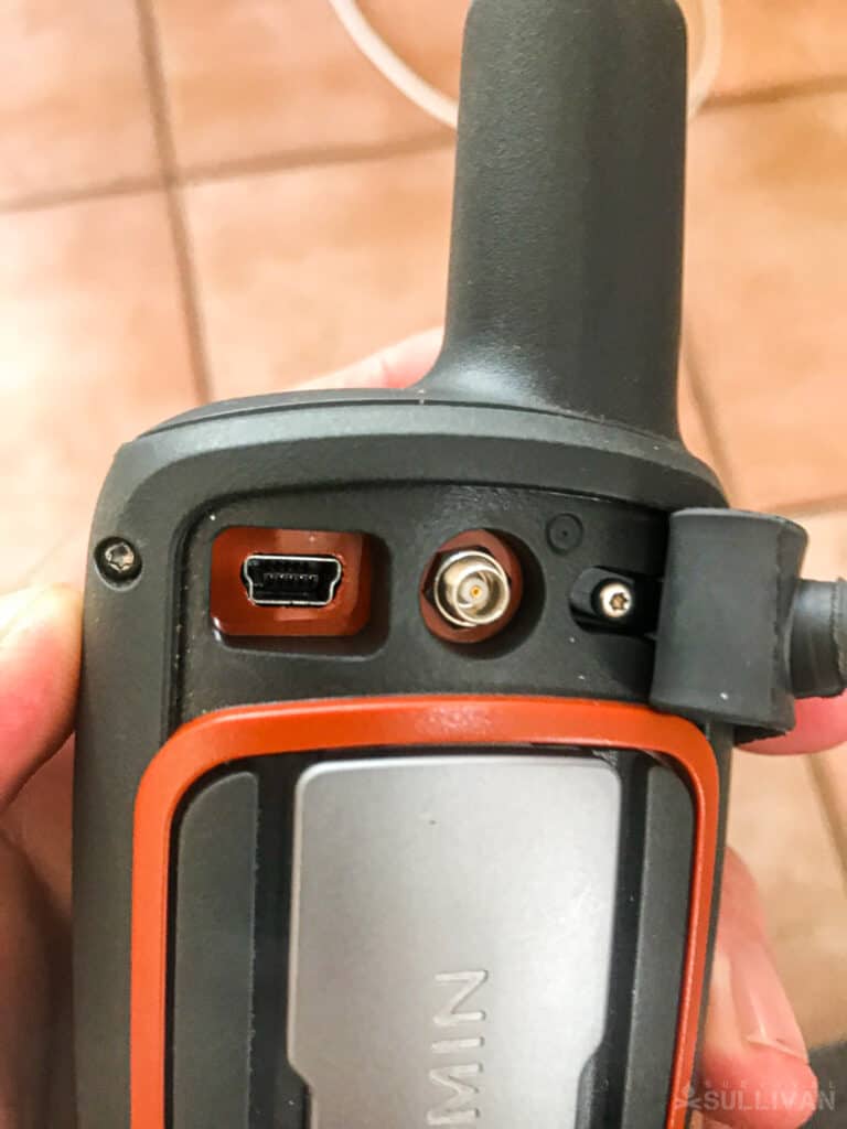
An absolute must is a GPS device that can be charged or attached to a power source using a USB cable.
My personal go-to is the Big Blue 28W solar charger and two solar charging batteries.
Keep your gear charged and maintained if you intend to depend on it for survival or in an emergency. Train with your gear and use it as often as you can to maintain your skill level.
Key Points
- The GPS will give you an exact position if 4 or more satellites are captured on your device. If only 3 satellites are available, your position could be off by hundreds of meters.
- Don’t buy cheap.
- Technology is power-hungry, plan for power back-ups.
- Plan for failure and you’ll succeed, have multiple sources for your navigation needs, and remember the 5 Ds of basic navigation:
- Distance – From your starting point to where you are going
- Duration – Time to your destination
- Direction – Plot your course and Shoot a Bearing, Remember Aiming Off
- Description – Terrain Land Marks, Handrails, and Catching Features
- Destination – Recognizable Reference Point
Now get out there and enjoy the wilderness.

Harrison Caine is a soldier, a hunter, a trained expert in hand-to-hand combat, hunting. He’s trained soldiers, fought wars, and provided defense services to refugees and U.S. officials. His experience in tough wilderness scenarios is unmatched